CenLA: Central Louisiana
 |
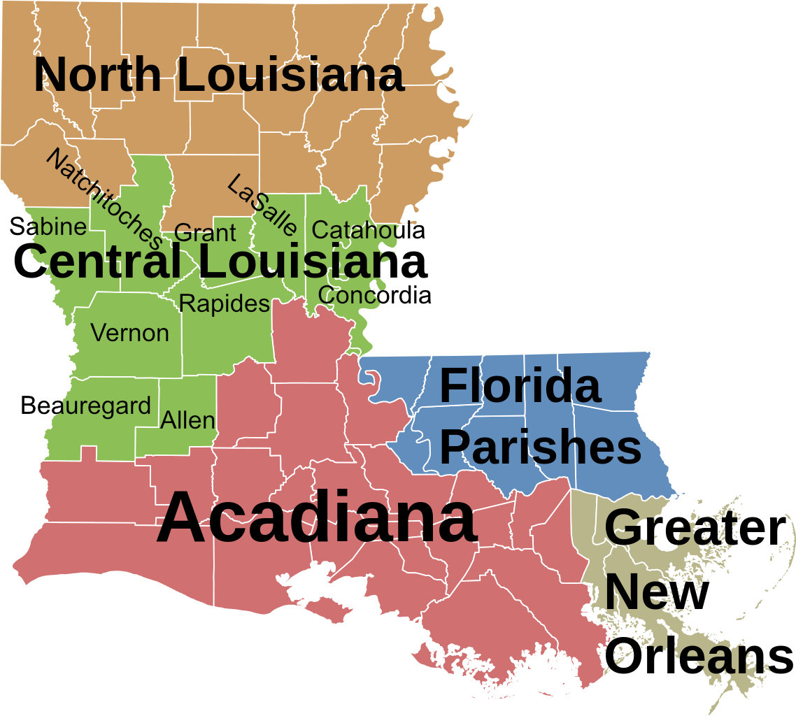
The State of Louisiana is commonly described as having five major regions, as shown in the map to the right.
Where is "CenLA"?
Central Louisiana, or just "CenLA," spans from the Sabine River and the Toledo Bend Reservoir in the west to the Mississippi River in the east. Sometimes it is referred to as "The Crossroads of Louisiana".
It lies north of Acadiana, and south of "North Louisiana". The Florida Parishes and the Greater New Orleans area lie to the southeast.
The State of Texas borders the region on the west, and the State of Mississippi on the east.
Extensive prairies, a piney hill region known as the Louisiana Central Hill Country, minor swamplands and deep deciduous forests make up the region's geography. It also has clear streams with sandy bottoms and large rivers such as the Red, Black, Sabine and Mississippi.
This region is home to Louisiana’s only national forest (Kisatchie), only federally designated wilderness area, multiple national wildlife refuges, the state’s longest hiking trail, and only designated National Wild and Scenic River (Saline Bayou).
The Kisatchie National Forest offers many opportunities for residents and visitors to enjoy and explore the beautiful natural scenery of Central Louisiana. The forest includes more than 604,000 acres, is spread across seven parishes.
The largest communities in CenLA are Alexandria, Pineville and Natchitoches.
How many Parishes are in CenLA?
The State of Louisiana does not have "counties" as regional governments below the state level, but instead has "parishes". Ten parishes are considered to lie within Central Louisiana:
| Parish | Parish Seat | Population (2020) |
| Allen | Oberlin | 22,750 |
| Beauregard | DeRidder | 36,549 |
| Catahoula | Harrisonburg | 8,906 |
| Concordia | Vidalia | 18,687 |
| Grant | Colfax | 22,169 |
| La Salle | Jena | 14,791 |
| Natchitoches | Natchitoches | 37,515 |
| Rapides | Alexandria | 130,023 |
| Sabine | Many | 22,155 |
| Vernon | Leesville | 48,750 |
| NOTE: Winn and Avoyelles Parishes are sometimes considered in "Central Louisiana" by some sources and organizations | ||
Business and Industry
 |
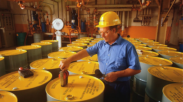
Major employers like Boise Cascade, Procter & Gamble, Roy O Martin, CLECO, UTLX Union Tank Car, Crest Industries and Weyerhaeuser make CenLA their home. Other major employers include healthcare facilities in many cities and towns, the hospitality industry, and Fort Polk in Leesville.
The Red River flows in the center of this region, through Alexandria and Pineville. Agriculture dominates in the alluvial plain along the Red River with crops such as cotton, soybeans, and corn prevailing.
The Central Louisiana Manufacturing Managers Council’s purpose is to enhance and further develop the competitive capacity of the manufacturing sector of the region.
The Advanced Manufacturing Technician Associate Degree program offered by Northwestern State University and Central Louisiana Technical Community College provides an opportunity for students to earn money while they attend school and work for a local employer in their chosen field.
For more information on CenLA business and industry, visit the website of the Central Louisiana Economic Development Alliance - Louisiana Central.
What attractions can be found for visitors to CenLA?
Central Louisiana features a variety of attractions and things to do. From museums and zoos, to outdoor recreation and historical sites, there is something to do for area residents, and visitors alike!
From Alexandria to Natchitoches, from Leesville to Vidalia, and all points in between, CenLA has recreational activities like fishing, camping, hiking, biking, and golfing for the entire family.
Water sports are popular at venues such as Toledo Bend Reservoir, Cane River, Kinkaid Lake, Buhlow Lake, Indian Creek Recreational Area, and the Fort Buhlow Recreation Area.
| about CenLA Attractions ... |
Higher Education
- Louisiana State University at Alexandria
- Northwestern State University
- Louisiana Christian University
- Central Louisiana Technical Community College (CLTCC)
Transportation & Infrastructure
- Alexandria International Airport (AEX)
- Central Louisiana Regional Port
- Union Pacific Railroad
- CPKC Railroad (formerly Kansas City Southern)
- Louisiana Department of Transportation & Development
- Jefferson Highway Association
More CenLA & Louisiana Resources
 |
- Central Louisiana Chamber of Commerce
- Concordia Chamber of Commerce
- Greater Vernon Chamber of Commerce
- Greater Beauregard Chamber of Commerce
- Natchitoches Chamber of Commerce
- Grant Chamber of Commerce
- Oakdale Chamber of Commerce
- Sabine Parish Chamber of Commerce
Interactive Map of Central Louisiana
